Indian State And Union Territory - Bihar
Chief Minister: Shri Nitish Kumar
Governor: Shri Rajendra Vishwanath Arlekar
Area: 94,163 sq. km sq. km
Capital: Patna
Population: 103804637
Male Population: 54185347
Female Population: 49619290
Total Literacy(%): 63.82
Male Literacy(%): 73.39
Female Literacy(%): 53.33
Sex Ratio: 916
No of District: 37
Principal Languages: Hindi
Other Languages: Hindi 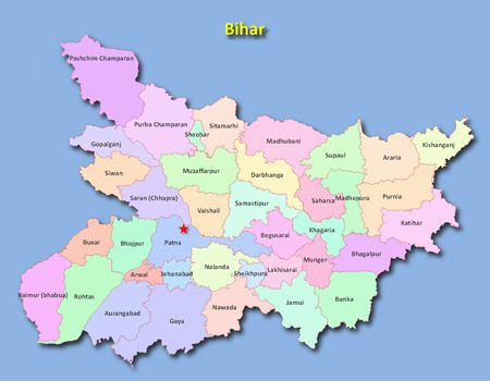
History and Geography
Bihar finds mention in the Vedas, Puranas, epics, etc., and was the main scene of activities of Buddha and the 24 Jain Tirthankars. Great rulers of the State before the Christian era were Bimbisar, Udayin, who founded the city of Pataliputra, Chandragupta Maurya and Emperor Ashoka of Maurya dynasty, the Sungs and the Kanvas. Then came the Kushan rulers followed by Chandragupta Vikramaditya of the Gupta dynasty. Muslim rulers made inroads into the territory during the medieval period. The first conqueror of Bihar was Mohammed- bin-Bakhtiar Khalji. The Tughluqs and then the Mughals followed the Khaljis.
One of the major states of the Indian Union, Bihar is bounded on the north by Nepal, on the east by West Bengal, on the west by Uttar Pradesh and on the south by Jharkhand. Bihar has a number of rivers, the most important of which is the Ganga. The other rivers are the Sone, Poonpoon, Falgu, Karmanasa, Durgawati, Kosi, Gandak, Ghaghara, etc.
Agriculture
Bihar has a total geographical area of about 93.60 lakh hectare, out of which only 55.54 lakh hectare is the net cultivated area with a gross cultivated area of 76.71 lakh hectare during 2008-09. The principal food crops are paddy, wheat, maize and pulses. Main cash crops are sugarcane, potato, tobacco, oilseeds, onion, chillies, jute and mesta. Bihar has a notified forest area of 6.22 lakh hectare , which is 6.65 per cent of its geographical area.
Industries
Major Industries are: Railway Wagon Plants of Bharat Wagon Limited at Muzaffarpur and Mokamah; Oil Refinery of Indian Oil Corporation at Barauni; Fertilizer Manufacturing Plant of HPCL at Barauni and PPCL at Amjhor; Cotton Spinning Mills at Siwan, Pandaul, Bhagalpur, Mokamah and Gaya; 13 sugar mills in private sector and 15 in the public sector located in south and north Bihar with a total crushing capacity of 45,000 TPD. In addition, distilleries at Gopalganj, West Champaran, Bhagalpur and Riga (in Sitamarhi district); Finished Leather Industry in West Champaran, Muzaffarpur and Barauni; Jute Mills at Katihar and Samastipur; Medicine Manufacturing Unit at Hajipur; Food Processing Units as also Vanaspati Manufacturing Units at Aurangabad and Patna; besides Kalyanpur Cement Limited at Banjari, are notable in the industrial map of Bihar.
Irrigation
Bihar has an irrigation potential of 28.73 lakh hectare. It is created through major and medium irrigation schemes and 6.63 lakh hectare is through minor irrigation schemes.
Transport
Roads: Up to March 2008, Bihar had 45721.059 km of pucca roads including 3734.38 km of national highways and 3766.029 km of state highways, 7992.65 km of major District Roads, 2828.00 km. of other District Roads and 27400 km. of Rural Roads.
Railways: Bihar has a fairly good railway network. There is a railway bridge at Mokamaha in north Bihar. A few railway routes connecting important places like Muzaffarpur-Samastipur-Barauni-Katihar and Muzaffarpur-Chapra-Siwan have been converted into broad gauge. The main rail junctions are at Patna, Gaya, Muzaffarpur, Katihar and Samastipur, etc.
Aviation: There is an international airport at Patna, besides landing grounds in all major districts of the State.
Tourist Centres
 Important places of tourist interest are Rajgir, Nalanda, Vaishali, Pawapuri (where Lord Mahavira breathed his last and attained Nirvana), Bodh Gaya, Vikramshila (ruins of Buddhist University of higher learning), Gaya, Patna (ancient city of Patliputra), Sasaram (tomb of Shershah Suri) and Madhubani (known for its famous Madhubani Paintings).
Mundeshwari Mandir (Kaimur), Rohtras Garh Fort (Rohtas), Jain Pilgrim Place, Kundalpur (Nalanda), Bihar School of Yoga (Munger), Manersharif Patna, Rural Tourist Place Nepura (Nalanda), Kesaria Stupa (East Champaran), Barabar Hills (Jehanabad) and Lauria Nandangarh are also important tourist places.
Career Opportunities in Fashion Designing
Fashion design is a dynamic and creative field that offers innovative career openings for those with a passion for style, creativity, and invention. This composition will explore the colorful job prospects in the fashion design assiduity, the original hires one can anticipate, and punctuate some o →
Commonwealth of Independent States (CIS)
Foundation Date: December 8, 1991 Headquarters: The Republic of Belarus Executive Secretaries: Sergei Lebedev Member Countries: 12 Commonwealth of Independent States (CIS) was established on December 8, 1991, and the leaders of the Republic of Belarus, the Russian Federation, and Ukraine signed an a →
What is Bitcoin?
In 2009, an unknown programmer by the name of Satoshi Nakamoto put forward a whitepaper that proposed a creation of new form of digital currency - cryptocurrency. Cryptocurrency functions the same way as regular currencies do in that its used as a means of exchange, unit of account and a store of va →
Food Safety and Standards Authority of India (FSSAI)
Headquarter: New Delhi Function and Objective of the Organization: The Food Safety and Standards Authority of India (FSSAI)has been established under Food Safety and Standards Act, 2006 which consolidates various acts & orders that have hitherto handled food-related issues in various Ministries →
Contribute to our Site
If you contribute your content to our site. Please mail us your content to editor@onlinegk.net